What is a Street Name?
Street Names
When you think of a street name, it simply just a sign on the street or on your gps that helps your get to the right building/house just a label on a map. But if you dig deeper, you’ll find that street names play a huge part in the history and of place. In London it holds the history, culture, values and power structures of the city. If you ever walk from West to East London that becomes even more apparent on the dynamics of street names and how they change from one borough to another. How many London streets are named after a member of the aristocrats, military officials, and politicians? How many are named after people who were socialites? Or named after memories of the British Empire? And its not all depressing some street names in London come from businesses from Pubs to Butcheries such as Angel Lane which was Angel Inn or Butcher Row. A reflection of the industries that made London the city it is.
Purpose of the Study
o This study is to explore London’s deep rooted societal dynamics embedded in something as niche as the city’s street names. By analysing these names, we hope to uncover the biases that have shaped the city’s identity over time particularly those tied to the patriarchy, class and colonialism. Our goal is more than just cataloguing theses names but to examine whose history is being erased and how we can shed a light onto how we commemorate a diverse range of figures in our currently urban environments as naming is a form of representation.
Why Do Street Names Matter in London?
o London is a city shaped by centuries of history, and street names are often the most immediate form of "memory" embedded in the urban space. From the legacy of the British Empire to more contemporary debates around who gets honoured in public spaces, London’s streets can reveal power dynamics that have shaped the city's development.
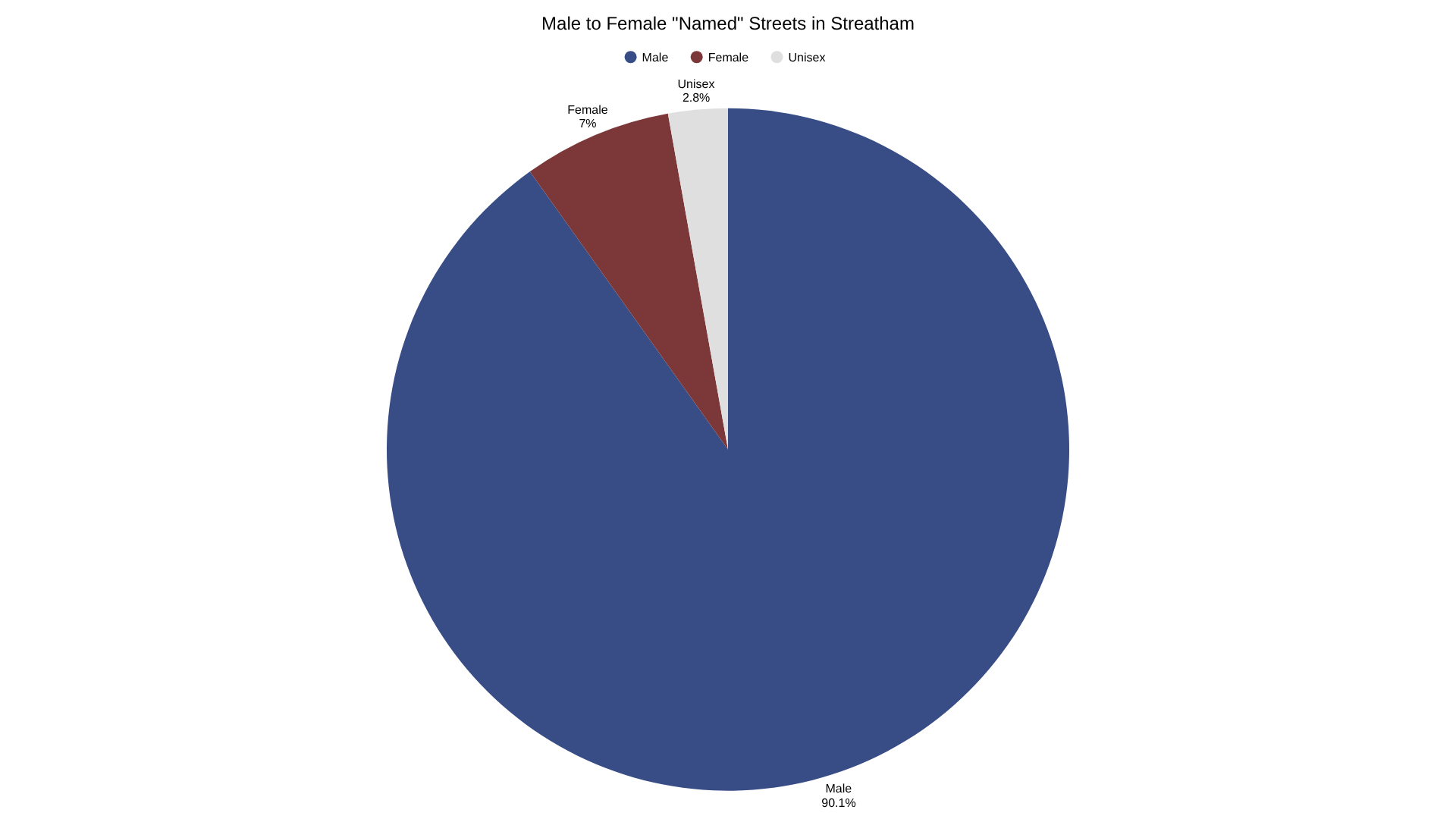
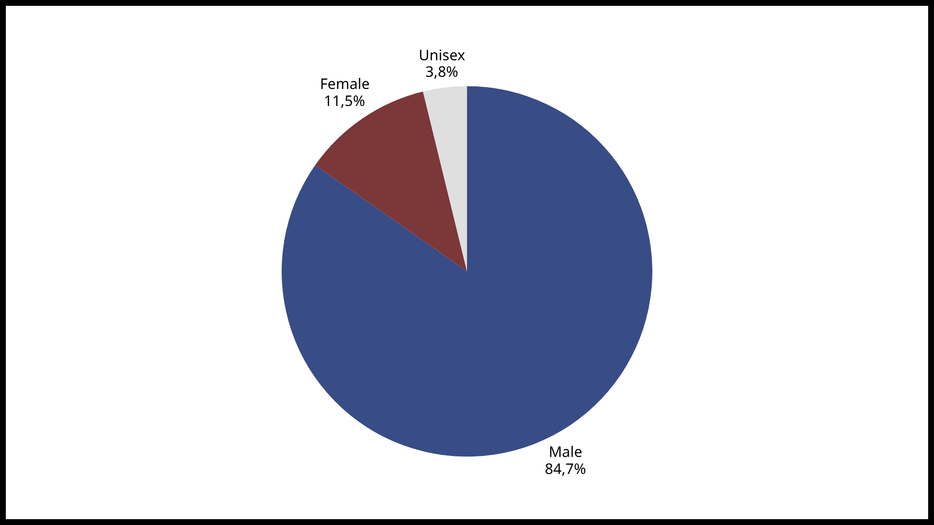
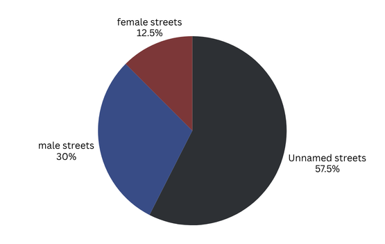
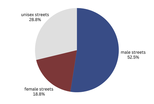
Key
o BLUE MAP (left-hand side) - visualises male streets across London
o RED MAP (right-hand side) - visualises female streets across London
o BLUE ICONS (left-hand side) - male streets
o RED ICONS (right-hand side) - female streets
o BLACK ICONS (left-hand side) - interesting/related streets
o Corresponding icons can be found on area info cards